How does a community's economic development become a civic responsibility?
In classical free-market economic theory, the "invisible hand" operates best when each person pursues their own best interests to maximize and distribute benefits. Therefore, the economy should be as free as possible from government interference. In practice, however, at all levels, the economy requires a public-private partnership to function. Debate over how much government and how unrestricted the private sector highlights challenges to the free market system.
Iowa and Competing Economic Philosophies
Iowa was first opened for U.S. settlement in the mid-19th century when two political parties with competing economic philosophies contended for power. The Democrats tended to represent small farmers who wanted minimal government interference and the lowest possible tax assessments. The Whigs tended to support government encouragement of economic growth through internal improvements like roads, support for a strong banking system and tariffs to protect American industries. Party lines in Iowa were not always in line with national leaders. Local communities benefited from the construction and maintenance of roads. There was strong support for federal land grants in the 1850s to railroads to four trunk lines from the Mississippi to the Missouri rivers. However, too many Iowans feared the power and instability of banks, and the first state constitution put strict restrictions on this aspect of the free enterprise system.
How one made money in a small town was not the only factor in the early equation. In many situations, improvements in living conditions depended upon community action outside of government. Churches, private schools beyond what the one-room school offered and social life were collective actions of the community, not the government. No matter how much an individual family earned, they could not enjoy a quality lifestyle if their community did not offer the desired opportunities. Civic engagement in addition to government activity was essential. That sometime meant volunteering and sometimes meant contributing financially to community events and projects.
Public-Private Partnership
Today, public and private initiatives are essential to maintain a healthy economy. Commerce cannot run without a solid infrastructure of roads and airports that the government maintains. In Iowa, community colleges train students at government expense to prepare for jobs in private industry. Government agencies match those looking for work with firms that want to hire them through workforce development programs and even provide direct grants or tax incentives to businesses that relocate in the state.
On the private side, local economic development organizations supported by public and private donations work hard to lure and retain private businesses. Local communities provide building sites and offer to expand utility services to new factories or office buildings. Development organizations promote quality in local schools, safety and recreation opportunities that will encourage business executives to think positively about the community.
How much should the government use taxpayer money to benefit private businesses? Why should private citizens invest their own money to support businesses in their communities? The answers lie in the close connection between the desire for quality of life amenities and the necessity for collective action to sustain them. Sometimes they can be achieved only through government action. Sometimes, it is more appropriate to work for them through private organizations. The dividing line between the two approaches has always been a point of controversy.
Supporting Questions
What geographic factors contribute to community growth and economic development?
- Iowa Patriot Letter about Important Rivers for Settlement, July 18, 1839 (Document)
- Iowa and Wisconsin Territories Map, 1842 (Map)
- Des Moines Rapids of the Mississippi River Map, 1843 (Map)
- "Engineer's Report" in The Davenport Gazette, January 9, 1851 (Document)
- "Council Bluffs & Saint Joseph Railroad - Letter from M. Jeff Thompson, of St. Joseph," May 22, 1858 (Document)
- Bird's-Eye View of Council Bluffs in Pottawattamie County, Iowa, 1868 (Map)
- "Illustrated Historical Atlas of the State of Iowa," 1875 (Image)
How does economic activity affect community growth?
- Sectional Map of Iowa, 1850 (Map)
- Population in Iowa in 1850 and 1860 U.S. Censuses, 1853/1864 (Document)
- "Stock in the M. & I.C.R.R.," February 24, 1854 (Document)
- "Railroad Jubilee at Rock Island," February 24, 1854 (Document)
- Parker's Sectional and Geological Map of Iowa, 1856 (Map)
- "River Items" Newspaper Article about Council Bluffs, Iowa, June 6, 1857 (Document)
- "Daily Southern Mail," June 20, 1857 (Document)
How can governments assist with a community’s economic growth?
- "Navigation of Mississippi River" Petition, January 18, 1836 (Document)
- "Davenport and Council Bluffs Railroad," December 20, 1849 (Document)
- "The Railroad" Newspaper Article, December 20, 1849 (Document)
- "Railroad Loan" Newspaper Article, June 6, 1857 (Document)
- "Mississippi and Missouri Railroad" Newspaper Article Part 1, June 20, 1857 (Document)
What civic responsibility do individuals have to assist with a community’s economic growth?
- "Local Matters - Important Railroad Meeting" Newspaper Article, February 24, 1854 (Document)
- "The Railroad Loan" Newspaper Article, June 6,1857 (Document)
- "Mississippi and Missouri Railroad" Newspaper Article Part 2, June 20, 1857 (Document)
- "Railroad Meeting in Saratoga" Newspaper Article, May 22, 1858 (Document)
| Economic Development and Community Growth Teaching Guide |
| Printable Image and Document Guide |
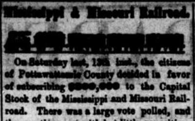
"Mississippi and Missouri Railroad" Newspaper Article Part 2, June 20, 1857
Description
On June 13, 1857, the people of Pottawattamie County voted to buy stock in the Mississippi and Missouri Railroad Company in the amount of $300,000. This editorial, published the following week in Council Bluffs, celebrated that vote but then continued to look to the future…
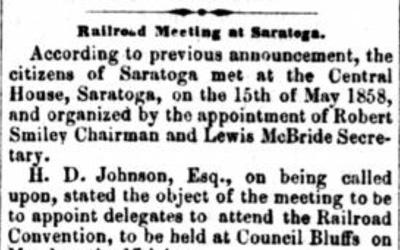
"Railroad Meeting in Saratoga" Newspaper Article, May 22, 1858
Description
This news story provided an account of a meeting held at Saratoga in Douglas County, Nebraska. Despite the promises made in the summer of 1857 by the Mississippi and Missouri Railroad Company, little progress had been made on the railroad’s construction across Iowa,…
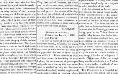
Iowa Patriot Letter about Important Rivers for Settlement, July 18, 1839
Description
This letter, addressed to "My Dear Friend," was written for The Iowa Patriot. The writer described the important rivers for settlement in Iowa, with an emphasis on the Mississippi River. Burlington served as the territorial capital before it was moved to Iowa…
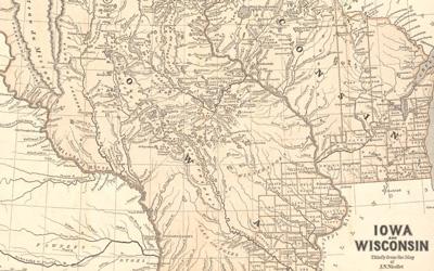
Iowa and Wisconsin Territories Map, 1842
Description
This map of the upper Midwest was included in an atlas of North America published between 1842 and 1845. The map highlights the Iowa and Wisconsin territories, both created in 1836. The Iowa territory had only been opened for settlement in 1836, following the conclusion of…
Des Moines Rapids of the Mississippi River Map, 1843
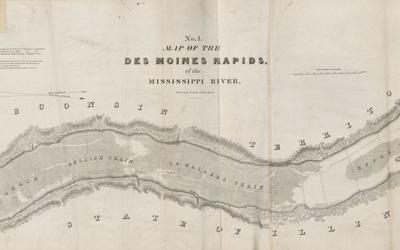
Description
This map was part of a collection of maps, drawings and surveys of North America, the United States and the world in 1843. Everything in the collection was created on the orders of the U.S. Congress.
"Engineer's Report" in The Davenport Gazette, January 9, 1851
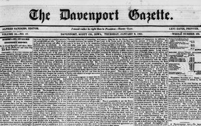
Description
Richard P. Morgan was an engineer who surveyed the route for a railroad from Davenport to Iowa City. In this letter published in The Davenport Gazette, Morgan described the results of that survey along with some of the economic opportunities that were…
"Council Bluffs & Saint Joseph Railroad - Letter from M. Jeff Thompson, of St. Joseph," May 22, 1858
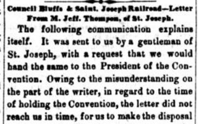
Description
In 1857, Pottawatomie County in western Iowa voted to buy $300,000 worth of stock in the Mississippi and Missouri Railroad Company to insure that the railroad would go through their city. An economic panic in 1857 kept the railroad company from starting work as they had…
Bird's-Eye View of Council Bluffs in Pottawattamie County, Iowa, 1868
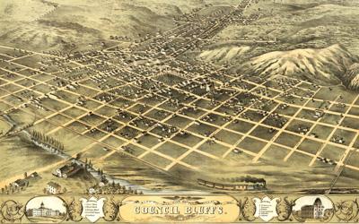
Description
This lithograph provided a perspective map of the city of Council Bluffs, Iowa, in 1868. The view of the city is from the southwest, looking to the northeast. The map included the physical features of the area as well as the built city.
"Illustrated Historical Atlas of the State of Iowa," 1875
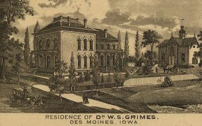
Description
The bottom two-thirds of the page provide a perspective map of the city of Muscatine, which was located on the Mississippi River and was one of the important river towns from Iowa's early history. This perspective map depicts the city in 1875 and was included in an atlas of…
Sectional Map of Iowa, 1850
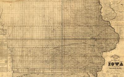
Description
This map was drawn by Deputy U.S. Surveyor Guy H. Carleton. The map used information gathered during the U.S. surveys of Iowa. The numbering of sections was based on the Fifth Principal Meridian and its baseline (see note in lower left corner of the map). Carleton included…
Population in Iowa in 1850 and 1860 U.S. Censuses, 1853/1864
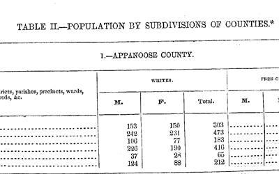
Description
In 1840, the Iowa territory was included in the U.S. Census, but the county population totals were provided. In 1846, Iowa became a state, and beginning in 1850, population totals were provided for Iowa's cities and towns, as well as for the counties. The city and town…
"Stock in the M. & I.C.R.R.," February 24, 1854
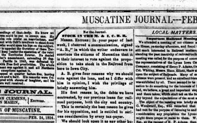
Description
This excerpt from the Muscatine Journal includes a letter to the editor in regards to the proposal to build a railroad from Muscatine to Iowa City and a report on number of hogs packed on the upper Mississippi River. Hog production provided a means for farmers to…
"Railroad Jubilee at Rock Island," February 24, 1854
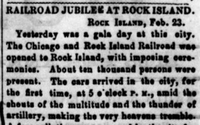
Description
As Americans settled the upper Midwest in the early 19th century, transportation to market was an important consideration. By the mid-19th century, railroads were becoming central to discussions of markets and transportation. This story from the Muscatine Journal…
Parker's Sectional and Geological Map of Iowa, 1856
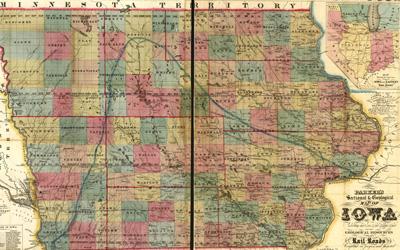
Description
In 1856, when this map was published, Iowa was celebrating its 10th year as a state. Nationally, the number of people moving West was increasing, and Iowa was an attractive destination with its fertile soil and relatively good access to markets in the East. This map was…
"River Items" Newspaper Article about Council Bluffs, Iowa, June 6, 1857
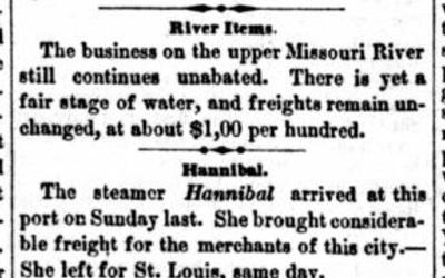
Description
Beginning in the mid-1840s, the Platte River Valley became an important avenue for settlers moving west to the Pacific coast. Council Bluffs located on the Missouri River just above the mouth of the Platte River became increasingly important as a jumping-off point for those…
"Daily Southern Mail," June 20, 1857
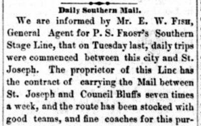
Description
This brief article announced a new contract for delivery of mail to Council Bluffs. The U.S. Constitution granted the power to establish post offices and post roads to Congress, so this would have been a federal contract.
"Navigation of Mississippi River" Petition, January 18, 1836
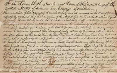
Description
The Iowa territory was opened to settlement in 1836. However, settlement was already well established in Illinois. The Mississippi River was an integral part of the transportation network in the upper Midwest and was essential for connecting settlers in the region to…
"Davenport and Council Bluffs Railroad," December 20, 1849
Description
This article was published in The Davenport Gazette and it shared the results of an information meeting regarding the building of a railroad from Davenport to Iowa City. Constructing a railroad was enormously expensive, and a variety of methods were used to…
"The Railroad" Newspaper Article, December 20, 1849
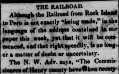
Description
In the first years of Iowa settlement, trade was oriented down the Mississippi River to St. Louis and New Orleans. With the advent of the railroad, Iowa communities began to look East. This story details efforts to raise money for the building of a railroad that would…
"Railroad Loan" Newspaper Article, June 6, 1857
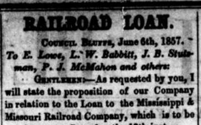
Description
By 1857, the efforts to build railroads which had started in eastern Iowa almost a decade earlier had reached the western borders of the state. This letter from Grenville M. Dodge explained the benefits to Council Bluffs and Pottawattamie County of choosing to help fund the…
"Mississippi and Missouri Railroad" Newspaper Article Part 1, June 20, 1857
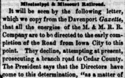
Description
Funding construction of railroads required support from multiple levels of government and a mix of public and private funds. The nature of railroads made the actions of any town or city of great interest to other towns or communities on the railroad’s proposed line. This…
"Local Matters - Important Railroad Meeting" Newspaper Article, February 24, 1854
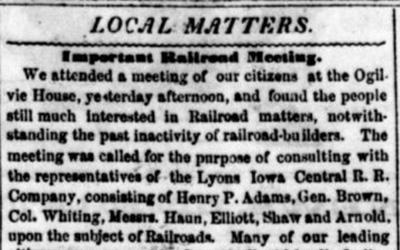
Description
This article reported on a meeting held in Muscatine with the Lyons Iowa Central Railroad Company. The railroad company was seeking funding to construct a railroad from Muscatine to Iowa City.
"The Railroad Loan" Newspaper Article, June 6,1857
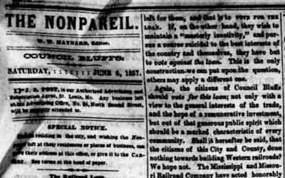
Description
In June 1857, Pottawattamie County had a vote on whether to purchase $300,000 worth of stock in the Mississippi and Missouri Railroad Company to aid in the construction of that railroad through the county. By this point, the railroad had been constructed from Davenport to…
Additional Resources
- Transportation in Iowa: A Historical Summary
The digital document from the Iowa Department of Transportation features an extensive history about the evolution of transportation in Iowa. - Rails Across Iowa
The website from Living History Farms looks at the continued history of railroads in Iowa. - Railroads
This webpage from Iowa Public Television features many resources and historical text about railroads in Iowa. - Grenville Mellen Dodge
This webpage from the University of Iowa provides a detailed biography of Grenville M. Dodge, a prominent railroad engineer in Iowa.
Iowa Core Social Studies Standards (9th-12th Grade)
Listed below are the Iowa Core Social Studies content anchor standards that are best reflected in this source set. The content standards applied to this set are high school-age level and encompass the key disciplines that make up social studies for students 9th through 12th grade.
| No. | Standard Description |
| SS-US.9-12.18. | Analyze the effects of urbanization, segregation, and voluntary and forced migration within regions of the U.S. on social, political, and economic structures. |
| SS-Geo.9-12.16. | Analyze relationships and interactions within and between human and physical systems to explain reciprocal influences. |
| SS.8.15. | Evaluate how economic decisions affect the wellbeing of individuals, businesses, and society. |
| SS.8.17. | Use historical evidence to evaluate the state of regional economies throughout early American history. |