What are the most important factors in determining state borders?
Americans are so accustomed to the current shapes of the states that make up the United States. History, however, tells a much different story. Iowa’s borders were caught up in the sectional struggle over slavery and became a contentious issue at home and in the U.S. Congress.
Path to Statehood
From the early years of the United States, Congress adopted a plan to admit western states into the Union on a status equal to the original thirteen. The region first became a territory with limited government. Once the population reached 60,000, the legislature could submit to the voters (white males 21 years and older) a proposal to draft a state constitution to send to Congress with an application for statehood. After several false starts, such a proposal was approved in 1844. However, it took two more years before Congress and Iowa voters could agree on the terms of a constitution.
While several issues were subjects of intense debate, Iowa’s borders were not at first. Because Missouri had already been admitted as a state, Iowa’s southern border was established (or so it seemed at the time). Similarly, the Mississippi River divided Iowa from Illinois and Wisconsin on the east. The northern and western borders had no so such fixed lines. Iowa’s first territorial governor, Robert Lucas, wanted Iowa to extend up to what is now Minneapolis and St. Paul, Minnesota, a large state indeed. The convention adopted the Lucas borders and sent them to Congress for approval.
At this point, Iowa’s admission became a subject of geo-political bickering. Because each state gets two Senators, northern interests wanted to carve out western lands into many small states that would never support slavery and cotton production. Many states, many “free” senators. Hence, they wanted to reduce the size of new states on the northern prairies and Great Plains. The South wanted just the opposite. They wanted big states from this region. Big states, fewer senators.
"Small State" vs. "Big State" Interests
When Iowa’s constitutional proposal reached Congress, Northern “small state” interests redrew the western border, not as the Missouri river as Lucas had proposed it, but a line some 80-100 miles back to the east. They also moved the northern border south from Lucas’ original proposal. Iowans balked at the smaller size. When the proposal came back to Iowa voters for approval, the measure failed. A compromise was reached setting the borders as we know them today.
While the constitution stated that Iowa’s southern border is the northern border of Missouri, it was unclear exactly where that line was to be drawn. The survey line ran from the Missouri River to a point "on the rapids of the Des Moines River." Unfortunately, there were several sets of rapids that answered that description. A heated exchange between the governors of Iowa and Missouri led to hastily assembled militias on both sides, but no shots were fired and the issue was settled by the U. S. Supreme Court.
Even today, issues surrounding the border occasionally arise. The Missouri River occasionally shifts its flow somewhat, and lands on either side might find themselves on the opposite side. Do affected residents now vote in a different state and pay on different tax rates? The courts have been able to settle the cases without resort to armed conflict.
The United States map would look much different in the Midwest if either of the first two Iowa boundary lines had been adopted. We would have had Rochester and Albert Lea, Iowa, and part of Minnesota’s capital would have been Hawkeye land. On the other hand, Council Bluffs, Sioux City, Atlantic, and Storm Lake would have been part of Nebraska. The shape of Iowa was the result of political compromise.
Supporting Questions
How did surveyors contribute to border decisions?
- Field Notes of Surveyor John Sullivan, 1816 (Document)
- Map of Surveyed Part of Iowa by J.H. Colton, 1839 (Map)
- Act of Congress to Define Iowa's State Boundaries, August 4, 1845 (Document)
- Surveyor Letter from Messers Hendershott and Minor in Keokuk, Iowa, September 20, 1850 (Document)
What is the process by which a territory becomes a state?
- Land Ordinance of 1785, May 18, 1785 (Document)
- Act of Congress to Admit Iowa and Florida into the Union, March 3, 1845 (Document)
- Final Act of Congress to Admit the State of Iowa into the Union, December 28, 1846 (Document)
- Iowa Boundaries as Defined by the State Constitution, 1857 (Document)
How are/were border disputes between states settled?
- Article Detailing Border Conflict Between Iowa and Missouri, May 17, 1845 (Document)
- "The Contested Boundary" Between Iowa and Missouri, October 30, 1847 (Document)
- U.S. Supreme Court Report by Surveyors about the Iowa, Missouri Border, December 17, 1850 (Document)
How did the conflict over slavery affect decisions about state borders?
- NW Land Ordinance for Ohio River Territories, July 13, 1787 (Document)
- Mitchell's School Atlas of the United States and Mexico, 1839 (Map)
- "Boundary Between Missouri and Iowa" Article in The Daily Crescent, April 3, 1849 (Document)
| How States Get Their Shapes Source Set Teaching Guide |
| Printable Image and Document Guide |
Field Notes of Surveyor John Sullivan, 1816
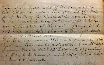
Description
John Sullivan was commissioned to conduct a survey to determine the boundary between American Indian lands and lands belonging to the United States of America. The line created controversy between the State of Iowa and the State of Missouri upon Iowa’s admission to the…
Map of Surveyed Part of Iowa by J.H. Colton, 1839
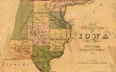
Description
This map was created in 1839 and includes the surveyed parts of Iowa. It shows the division of Iowa into counties, some of which have changed. The map also shows physical features and boundary lines created by treaties with American Indians. Township lines…
Act of Congress to Define Iowa's State Boundaries, August 4, 1845
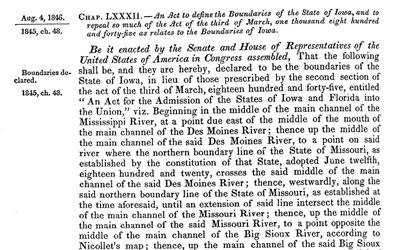
Description
This law was passed in August 1846 in response to the dispute over the border between the State of Missouri and the State of Iowa. The Act referred the matter to the U.S. Supreme Court as the final arbiter in the conflict.
Surveyor Letter from Messers, Hendershott and Minor in Keokuk, Iowa, September 30, 1850
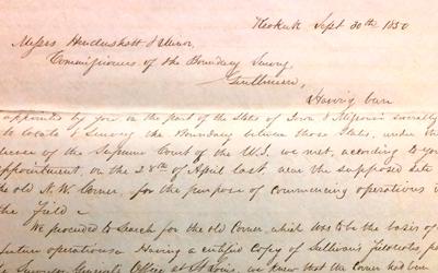
Description
This letter was a report from surveyors commissioned by the U.S. Supreme Court to confirm a boundary line between Missouri and Iowa.
Land Ordinance of 1785, May 18, 1785
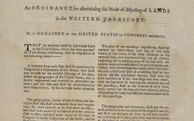
Description
The Land Ordinance of 1785 was passed by the U.S. Congress under the Articles of Confederation. It laid out the process by which lands west of the Appalachian Mountains were to be surveyed and sold. The method of creating townships and sections within townships was used for…
Act of Congress to Admit Iowa and Florida into the Union, March 3, 1845
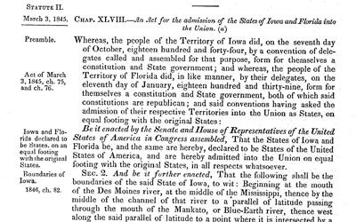
Description
This is a document from the U.S. Congressional Record. These pages show the congressional acts that brought Iowa and Florida into the Union. Iowa was admitted as a free state and Florida was admitted as a slave state, according to their respective state constitutions. The…
Final Act of Congress to Admit the State of Iowa into the Union, December 28, 1846
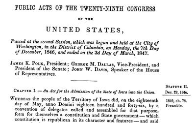
Description
This Act of Congress is the final step in Iowa’s admission into the Union. The Act references the conflict over the boundaries defined in an 1845 Act of Congress. This law also states that Iowa followed the NW Ordinance by…
Iowa Boundaries as Defined by the State Constitution, 1857
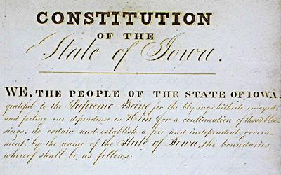
Description
This document is the official first constitution of the State of Iowa. Iowans participated in three constitutional conventions in 1844, 1846 and 1857 - the first constitution was rejected by voters. This version, from 1857, was approved by voters.
Article Detailing Border Conflict Between Iowa and Missouri, May 17, 1845
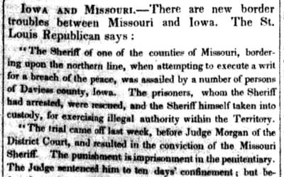
Description
This document is a newspaper article that appeared in the Weekly National Intelligencer, a Washington D.C.-based newspaper. The article appeared on May 17, 1845, and describes conflict between the state of Missouri and the territory of Iowa.
"The Contested Boundary" Between Iowa and Missouri, October 30, 1847
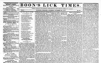
Description
This newspaper article from 1847, after Iowa’s admission to the Union, tells how both Iowa and Missouri have hired lawyers to present their cases regarding their shared border to the U.S. Supreme Court.
U.S. Supreme Court Report by Surveyors about the Iowa, Missouri Border, December 17, 1850
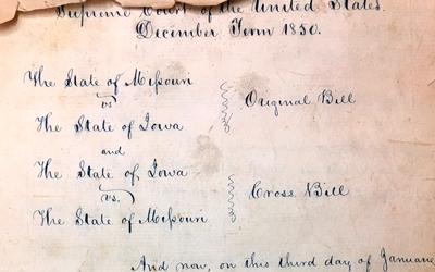
Description
This report to the U.S. Supreme Court was submitted by surveyors who had been commissioned to re-survey the southern border of Iowa after Missouri and Iowa sued each other. The surveyors particularly point out the difficulty of confirming the line surveyed in 1816 by…
NW Land Ordinance for Ohio River Territories, July 13, 1787
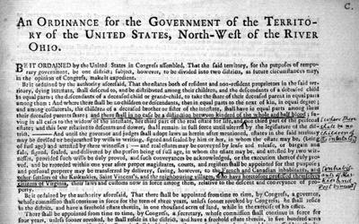
Description
This ordinance was passed July 13, 1787, and it specified the steps necessary for the territories north and west of the Ohio River to become states on the same footing as the original 13. It also outlined a Bill of Rights to be guaranteed in the territories. The plan put…
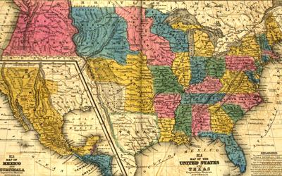
Mitchell's School Atlas of the United States and Mexico, 1839
Description
This map appeared in Mitchell’s School Atlas in 1839. It shows the territories formed from the Louisiana Territory Purchase as well as several states that had already been carved from Louisiana Territory. The Iowa territory is shown in pink.
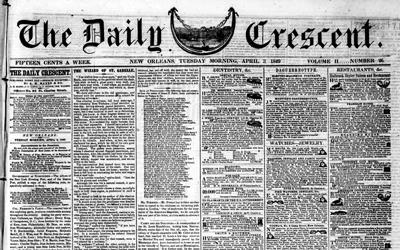
"Boundary Between Missouri and Iowa" Article in The Daily Crescent, April 3, 1849
Description
This newspaper article appeared in the New Orleans newspaper, The Daily Crescent. The article announced that the conflict over the border dispute between the states of Iowa and Missouri was settled. Iowa had been admitted as a state in December 1846, with the…
Additional Resources
- The Goldfinch: Iowa History for Young People, Spring 1976
This Iowa history magazine for children was published quarterly by the State Historical Society of Iowa from 1975-2000. Each issue focuses on a theme and this particular volume highlighted the development of Iowa's government on its path to statehood. - The Goldfinch: Iowa History for Young People, Volume 4, No. 3, February 1983
This Iowa history magazine for children was published quarterly by the State Historical Society of Iowa from 1975-2000. Each issue focuses on a theme and this particular volume highlighted the creation of Iowa's boundaries. - "To Shed Our Blood for Our Beloved Territory: The Iowa-Missouri Borderland," Derek R. Everett, The Annals of Iowa (Volume 67, No. 4, Fall 2008)
This Annals of Iowa essay focuses on the "border war" between Iowa and Missouri as the former approached statehood. - "The Southern Boundary of Iowa," Frank E. Landers, The Annals of Iowa (Volume 1, No. 8, 1895)
This Annals of Iowa essay focuses on the conflict and compromise that led to the southern border of Iowa. - "The Border War Between Iowa and Missouri, on the Boundary Question," Alfred Hebard, The Annals of Iowa (Volume 1, No. 8, 1895)
This Annals of Iowa essay features a look at the border conflict that developed between Iowa and Missouri as Iowa reached statehood.
Iowa Core Social Studies Standards (8th Grade)
Listed below are the Iowa Core Social Studies content anchor standards that are best reflected in this source set. The content standards applied to this set are elementary-age level and encompass the key disciplines that make up social studies for eighth grade students.
| No. | Standard Description |
| SS.8.14. | Examine and explain the origins, functions and structure of government with reference to the US Constitution and other founding documents, branches of government, bureaucracies, and other systems and its effectiveness on citizens. (21st century skills) |
| SS.8.21. | Analyze connections among early American historical events and developments in broader historical contexts. |
| SS.8.23. | Explain multiple causes and effects of events and developments in early American history. |
| SS.8.25. | Examine the evolution of the function and structure of government in Iowa. |