Image

Description
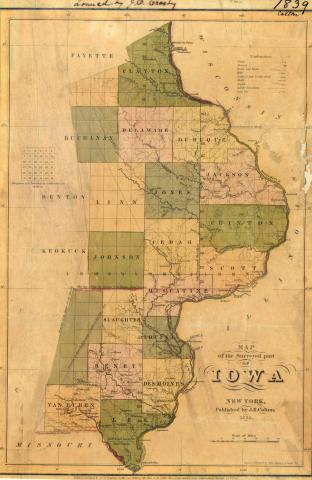
This map was created in 1839 and includes the surveyed parts of Iowa. It shows the division of Iowa into counties, some of which have changed. The map also shows physical features and boundary lines created by treaties with American Indians. Township lines also are drawn on the map.
Source-Dependent Questions
- Consider the Land Ordinance of 1785 and the NW Ordinance of 1787. How does this map reflect the requirements from those documents?
- Compare this 1839 map with a modern map of Iowa and a satellite image of Iowa. What differences do you see?