Image

Description
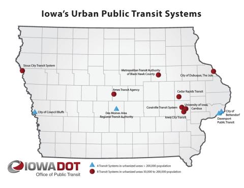
A 2014 map showing the urban public transit systems in Iowa. Two categories are represented: areas of 0-200,000 people and areas of more than 200,000. Interstate-80 connects the three urban transit systems in areas of more than 200,000.
Transcript of "Iowa's Urban Public Transit Systems"
Source-Dependent Questions
- How many urban public transit systems exist in Iowa? How many transit systems are in areas with more than 200,000 people?
- What service is the State of Iowa providing for citizens?
Citation Information
"Iowa's Urban Public Transit System," Iowa Department of Transportation (DOT), 2014. Courtesy of Iowa DOT