Image

Description
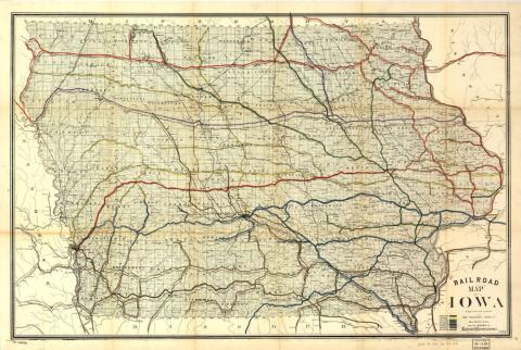
The map shows the many railroads running through the state of Iowa in 1881. It was published by the Western Litho Company, but was created by the Iowa Board of Railroad Commissioners, which served as an independent regulatory railroad agency.
Source-Dependent Questions
- How many rail lines appear on the map?
- The map was stamped by the Library of Congress in 1935. However, what year does it appear that this map was made?
- How does this map help answer the supporting question: How do people and goods move throughout Iowa?
- Compare this photo to the Bird's-Eye View of Iowa City and the photo of farm land in Grundy County. Based on these photos, describe the changes to how people and goods have moved throughout Iowa over the years.
Citation Information
"Railroad map of Iowa, 1881," Iowa Board of Railroad Commissioners, Western Litho Co., 1881. Courtesy of Library of Congress