Image

Description
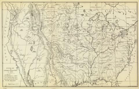
The map shows American Indian tribe locations as of 1833. The map was created by George Catlin, an American painter who specialized in portraits of Native Americans in the Old West.
Source-Dependent Question
- Using the timeline from "How the Meskwaki and Sauki Tribes became Three Separate "Sac & Fox" Tribes," what is the path the Meskwaki took on the map?