Image

Description
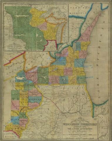
This 1838 map shows the territory labeled Wisconsin. The map shows the Wisconsin Territory existing on both sides of the Mississippi River, including territory that had been part of the Louisiana Purchase and would become the State of Iowa
Source-Dependent Questions
- This 1838 map shows the Wisconsin Territory. Summarize what you observe about this map related to Iowa.
- Iowa was part of the Louisiana Purchase. Look at where the Des Moines River empties into the Mississippi River. Compare it to the same point on the 1805 map of Louisiana.
- What was the effect of George Rogers Clark and his military success at forts on the east side of the Mississippi River?
Citation Information
Young, J. H., "Map of the settled part of Wisconsin Territory," 1838. Courtesy of University of Iowa Libraries and Archives