Image

Description
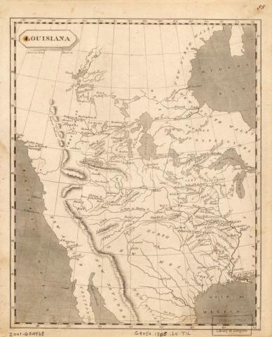
This 1805 map shows the Louisiana Territory. On the map, the forts of Kaskaskia and Cahokia can be seen on the east side of the Mississippi River. George Rogers Clark led Americans to capture both forts during the Revolutionary War, leaving the United States in possession of them when the Treaty of Paris was negotiated.
Source-Dependent Questions
- On this 1805 map, find the Des Moines River and the point at which it empties into the Mississippi River. What do you notice about its proximity to the forts Kaskaskia (Kaskaskias) and Cahokia (Kahokia) which George Rogers Clark captured during the American Revolution?
- When the French were looking to sell Louisiana, how might the proximity of the American held forts to the Louisiana Territory have impacted who the French were willing to sell it to? What is the significance of this proximity?
Citation Information
Lewis, Samuel and Aaron Arrowsmith, "Louisiana," 1805. Courtesy of Library of Congress