Image

Description
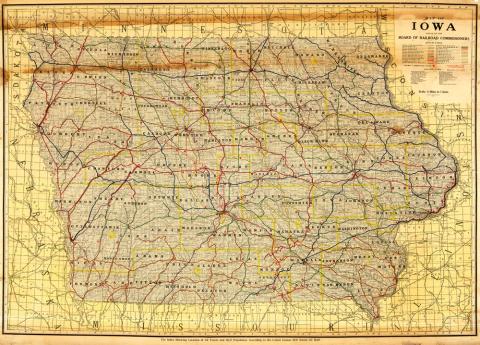
The transportation map features more than 26 railroads in Iowa in 1915. The map, which was published by Rand McNally and Company, includes the railroad lines of companies such as the Wabash Railroad, the Union Pacific Railroad Company and the Atlantic Northern Railroad.
Source-Dependent Question
- How did the railroad change between 1881 and 1915? Use this 1881 map to make the comparison.
Citation Information
"Map of Iowa, issued by the Board of Railroad Commissioners, 1915," Rand McNally and Company, Iowa Board of Railroad Commissioners, 1915. Courtesy of University of Iowa Libraries