Image

Description
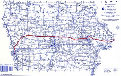
This is an Iowa road map from 1994, and it shows the original route of the Lincoln Highway in red.
Source-Dependent Questions
- Look closely at the historical route (in red) of the Lincoln Highway. You may notice that in some areas (for example, near Cedar Rapids) are different than the more recent route. Why do you think the route was altered compared to the more recent version of Highway 30?
- Compare this to a current road map of Iowa. What do you specifically notice about the historic route that is different than today's highway? What towns are now bypassed by the new Highway 30 route?
- Connecting to the text, how do you think the historical route influenced small town Iowa life? Can you infer how the more modern route could have affected the bypassed smaller towns?