Image

Description
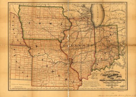
This is a railroad map of the American Midwest. The map shows Indiana, Illinois, Missouri and Iowa.
Source-Dependent Questions
- What does this map show? What is its purpose?
- Which states are visible on the map?
- Name a railroad line that runs through Iowa.
- Name some things that you notice on this map that make Iowa unique as compared to the other states featured.
Citation Information
Colton, G. Woolworth and Rufus Blanchard, "Indiana, Illinois, Missouri & Iowa with parts of adjoining states," 1858. Courtesy of Library of Congress