Image

Description
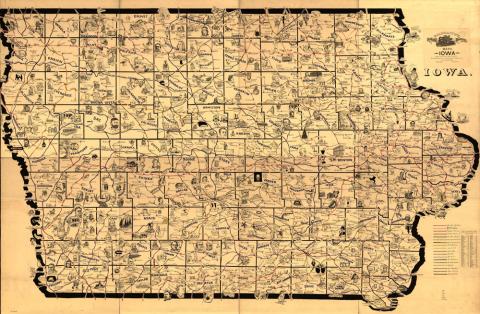
This is a large-scale map of Iowa that shows the routes and post offices of the Railway Mail Service. This map was designed by Chicago railway mail clerk Frank H. Galbraith to help employees of the Railway Mail Service quickly locate counties and post offices. The maps were rented for practicing or prospective workers, who numbered over 6,000 and traveled over a million miles a year on the rails sorting mail.
Transcript of Galbraith Railway Mail Service Map Key
Source-Dependent Questions
- Describe what this map is designed to show.
- Find the county that you live in. Which counties border your county?
- Which direction is Story County from Warren County?
- Which rail lines run through Sioux County?
- Which rail line would you need to take to travel from Burlington to Cedar Rapids?
- How might this map be useful in understanding Iowa, its unique geography and location?
Citation Information
Galbraith, Frank H., "Galbraith's railway mail service maps, Iowa," 1897. Courtesy of Library of Congress