Description
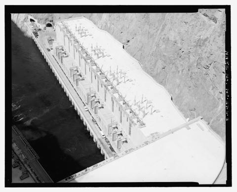
This photograph shows an aerial view of the Hoover Dam with a power station at the top. On one side of the dam, there is visible water, while on the other side, there is none. The Hoover Dam is on the border between Nevada and Arizona. It was constructed between 1931 and 1936 during the Great Depression and was dedicated on September 30, 1935, by President Franklin D. Roosevelt. Its construction was the result of a massive effort involving thousands of workers, and cost over one hundred lives. The Hoover Dam generates, on average, about 4 billion kilowatt-hours of hydroelectric power each year for use in Nevada, Arizona, and California - enough to serve 1.3 million people.
Source-Dependent Questions
- Describe the photo above. What man-made features do you notice?
- What type of energy is being produced in this image?
- What are a few ways that this land has been changed by humans?
- How can this image be used as evidence that humans modify their physical environments to provide energy?
Citation Information
"Hoover Dam, Circuits 1-15, U.S. Highway 93, Boulder City, Clark County, NV," Date Unknown. Courtesy of Library of Congress