Image

Description
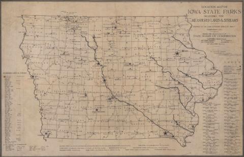
This map of Iowa shows the locations of its state parks in 1927.
Source-Dependent Questions
- On the map, a star in a circle is the symbol for a State Park. How many state parks are there in Iowa in 1927?
- After looking at the map, refer to the Legislation on State Parks in Iowa. What connections can be made between the legislation and where the parks are located?
- Find the county you live in. Is there a state park in your county? What is the name of the state park? If there isn’t one in your county, what is the closest state park to your county?
Citation Information
"Location Map of Iowa State Parks Including the Meandered Lakes and Streams," 1927. Courtesy of Iowa State University Library Special Collections and University Archives