Description
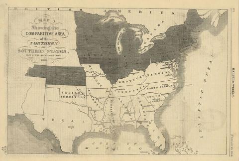
This 1861 map shows the comparative area of the northern and southern states east of the Rocky Mountains. The Civil War lasted from 1861 to 1865. The North had a population of 22 million people to help work or become soldiers, with the South's population set at about 5.5 million. The North had many roads, canals and 22,000 miles of railroad tracks to move soldiers and supplies throughout the North. The South only had about 9,000 miles of track. The Confederacy had a strong military tradition with many officers they used in battles. Southern farms supplied food to its soldiers. The South also had a strategy which was to defend itself until the North got tired of fighting. Southern soldiers mostly fought on land that they knew, while the North had to try to move in and take control large areas of the South.
Source-Dependent Questions
- Look closely at the map, count the northern states, those against slavery, and the southern states, those that wanted slavery. Which side had the most states?
- The north had 22 million people and the south had 5.5 million. How would the total amount of people and the number of states for each side impact the outcome of the war?
Citation Information
"Map showing the comparitive area of the Northern and Southern states east of the Rocky Mountains," 1861. Courtesy of Library of Congress