Image

Description
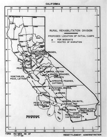
The map was designed to assist Dust Bowl families in relocating to migrant camps in California. It was created by the Rural Rehabilitation Division to show areas where different crops are grown, proposed location of initial camps for migrants and routes of migration.
Transcript of Proposed Migrant Camps in California Map
Source-Dependent Questions
- Why would people displaced from their homes during the Dust Bowl be considered migrants?
- List the different crops that the map suggests be grown in California. How do these crops compare to what is grown in Iowa today?
- Why might people from the Great Plains want to see a map like this during the Dust Bowl era?
- How does this map help answer the supporting question: How did people respond to the Dust Bowl?
Citation Information
"[Map of California by the Rural Rehabilitation Division showing areas where different crops are grown, proposed location of initial camps for migrants, and routes of migration]," 1935. Courtesy of Library of Congress