Image

Description
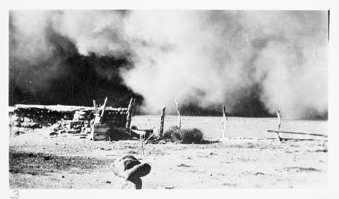
The photograph by J.H. Ward shows a dust storm moving in on a farm in Baca County, Colorado. Baca County is located in the southeasternmost part of the state.
Source-Dependent Questions
- Using evidence from this photo, describe what is happening in this image.
- Describe the ground and soil. Does this land look like land that a farmer could grow crops on? Use evidence from the photo to explain.
- Baca County is the southeasternmost county in Colorado. Compare this photo with Destroyed Orchard in Cimarron County, Oklahoma, which is located in the Oklahoma panhandle, directly south of Baca County. Using evidence from both photos, explain how did the Dust Bowl impacted the neighboring states?
Citation Information
Ward, J.H., "Dust storm. Baca County, Colorado," 1935. Courtesy of Library of Congress