Image

Description
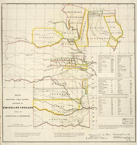
This map was created by the Topographical Bureau to show the assigned territory of tribes west of the Mississippi. The assignments were made as a result of the Indian Removal Act in 1830, which gave the president the authority to create and assign tribes to certain areas of land west of the Mississippi.
Transcript of Lands Assigned to American Indians Map
Source-Dependent Questions
- From this map, can you tell what method was used to determine the boundary lines between tribes? Take the population statistics into account in your answer.
- According to the map, by what two methods did the Sac and Fox lose their land?
Citation Information
"Map showing the lands assigned to emigrant Indians west of Arkansas and Missouri," 1836. Courtesy of Library of Congress