Image

Description
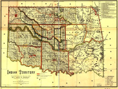
This map was created by the Office of Indian Affairs in 1889. It shows the location of American Indian reservations in the modern state of Oklahoma. The Cherokee occupy the large northeast section of the map. The Sac and Fox tribes, who did not move back to Iowa, are in the center.
Transcript of American Indian Reservations in Oklahoma Map
Source-Dependent Questions
- Spend a few minutes studying this map, list three to five things about that stand out to you and why you noted those.
- From this map, what can you conclude about how borders between tribes were created?
- Looking at the references part of the map, what conflict(s) might arise based on how the land was divided?
Citation Information
Maxwell, Charles A., "Indian territory: compiled under the direction of the Hon. John H. Oberly, Commissioner of Indian Affairs, by C.A. Maxwell," 1889. Courtesy of Library of Congress